
 By kevin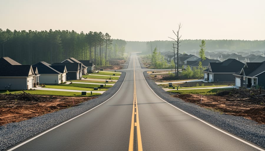
Urban sprawl is the extension of low-density residential, commercial, and industrial development beyond a city’s boundaries, characterized by car-dependent neighborhoods on large lots, separated zones for living and working, and rapid consumption of natural lands. For Canadians watching forests and farmland vanish beneath sprawling subdivisions, the environmental toll is urgent and measurable.
As cities push outward rather than growing denser, they fragment wildlife habitats, pave over watersheds, and lock residents into automobile dependency that drives up greenhouse gas emissions. Atlanta, Georgia offers a stark warning: its population mirrors Barcelona’s, yet it sprawls across an urban footprint 26 times larger. The pattern repeats across Canadian metropolitan regions, where agricultural land and sensitive ecosystems face conversion into asphalt and lawns at accelerating rates.
The consequences ripple through every environmental system. Sprawl increases impervious surfaces that disrupt natural water cycles, extends daily travel distances that multiply air pollution, and consumes energy, land, and soil at rates far exceeding compact development. When growth leapfrogs into rural areas unplanned, it doesn’t just change landscapes. It fundamentally alters how water flows, where wildlife can survive, and how much carbon our communities emit.
Understanding these mechanisms matters because sprawl isn’t inevitable. Legal frameworks, land-use planning, and collaborative approaches that center Indigenous land stewardship offer pathways to growth patterns that protect rather than degrade the environment. This article breaks down exactly how sprawl harms ecosystems, why certain impacts prove particularly damaging in Canadian contexts, and what legal tools communities can deploy to shape development that respects environmental limits.
What Urban Sprawl Means: A Plain-Language Definition
Urban sprawl is the extension of low-density residential, commercial, and industrial development into areas beyond a city’s boundaries that occurs unplanned or uncoordinated. Rather than cities growing upward through denser buildings and infill development, sprawl pushes outward, consuming farmland, forests, and natural areas at the urban fringe. This expansion pattern creates communities where daily destinations spread far apart and residents depend almost entirely on cars to reach work, school, shops, and services.
Three characteristics define sprawl development. First, it features low-density construction on large lots, typically greater than one acre per household. Second, it geographically separates the places where people live, work, attend school, and shop, forcing them to travel between these destinations multiple times daily. Third, it creates high dependence on automobiles for nearly all trips, since distances are too great for walking or cycling and the scattered layout makes public transit inefficient.
- Low-density development
- Building patterns that spread homes, businesses, and infrastructure over large areas with significant space between structures, typically on lots exceeding one acre.
- Impervious surface area
- Hard surfaces like roads, parking lots, and buildings that prevent water from soaking into the ground, increasing runoff and reducing natural water filtration.
- Habitat fragmentation
- The process of dividing continuous natural areas into smaller, isolated patches that disrupt wildlife movement and threaten species survival.
- Urban expansion
- The physical growth of cities and towns outward into surrounding rural or undeveloped land.
- Encroachment
- The gradual intrusion of urban development onto agricultural land, forests, wetlands, and other natural or rural environments at city edges.
The scale of sprawl becomes clear through comparison. Atlanta, Georgia serves as a frequently cited example: despite having a population similar to Barcelona, Spain, Atlanta occupies an urban area 26 times as large. This dramatic difference illustrates how sprawl consumes vast territories to house the same number of people that compact European cities accommodate in far smaller footprints. The environmental consequences of this land-intensive development pattern ripple through ecosystems, watersheds, and the atmosphere.
How Urban Sprawl Works: The Mechanics of Outward Expansion
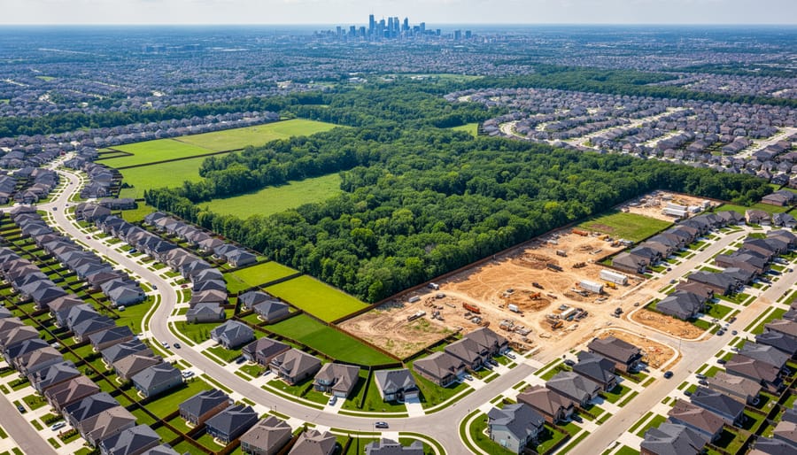
Urban sprawl unfolds through a predictable yet destructive pattern: cities expand horizontally across the landscape instead of building denser, more compact neighborhoods within existing boundaries. This outward growth is driven by a combination of economic forces, policy decisions, and infrastructure investments that make undeveloped land at the city’s edge seem like the path of least resistance for new development.
The process typically begins with transportation corridors. When highways extend into rural areas, they reduce travel time from the urban core and suddenly make previously remote land viable for development. Property developers recognize opportunity where land prices remain low compared to established urban neighborhoods. A farmer might sell acreage that has been in the family for generations to a developer who can pay far more than agricultural use would ever generate. That land gets subdivided into large residential lots, often an acre or more, where single-family homes spread across the landscape rather than clustering efficiently.
Several interconnected factors perpetuate this expansion pattern:
– Zoning policies that mandate minimum lot sizes and separate residential areas from commercial and employment centers
– Highway construction that extends infrastructure deep into previously undeveloped territory
– Cultural preference for detached single-family homes with private yards over denser housing forms
– Land speculation as investors purchase rural parcels anticipating future development value
– Municipal fragmentation where competing jurisdictions race to attract development and expand tax bases
As residential subdivisions take root on former farmland, commercial development follows the population. Strip malls, big-box stores, and office parks emerge along arterial roads, each surrounded by vast parking lots. These destinations sit miles apart, connected only by automobile-dependent road networks. A resident might drive five miles to work, three miles in another direction for groceries, and four miles to reach their child’s school. Every daily activity requires a separate car trip because the geographic separation makes walking, cycling, or transit impractical.
This pattern consumes agricultural land, forests, and natural areas at an accelerating rate. What was once productive farmland or wildlife habitat becomes pavement, rooftops, and manicured lawns. The transformation is usually permanent. Even when sprawl development fails economically, the land rarely returns to its natural state. Instead, it sits degraded, its ecological functions destroyed, its soil sealed beneath impervious surfaces that prevent water infiltration and disrupt natural drainage patterns.
Types of Environmental Impacts from Urban Sprawl
Increased Energy Consumption and Greenhouse Gas Emissions
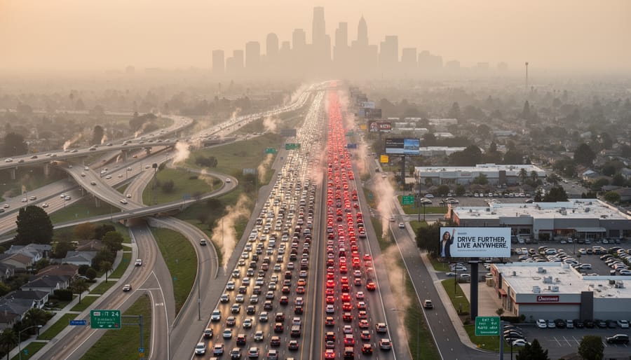
Urban sprawl fundamentally restructures how people move through their daily lives, and that restructuring comes with a steep energy cost. When residential neighborhoods sit miles from workplaces, schools cluster in separate zones from shopping districts, and every errand requires a car trip, the cumulative distance people drive each day skyrockets. This geographic separation of daily activities, a defining feature of sprawl, means families routinely travel 20, 30, or 40 miles roundtrip for work, school runs, grocery shopping, and after-school activities. Those extended trips add up fast, multiplying fuel consumption and vehicle emissions across entire metropolitan regions.
The automobile dependence baked into sprawl patterns creates a vicious cycle. Without concentrated development to support viable public transit, bus routes become infrequent and impractical. Walking or cycling to destinations becomes impossible when they’re separated by highway interchanges and miles of low-density subdivisions. Residents have no realistic alternative to driving, which locks communities into high per-capita vehicle use even as concerns about climate change intensify. Every additional mile driven releases carbon dioxide, nitrogen oxides, and particulate matter into the atmosphere, directly raising greenhouse gas emissions that accelerate global warming.
Air quality suffers predictably. More cars on longer trips mean higher concentrations of exhaust pollutants, contributing to smog formation and respiratory health problems in sprawling metros. Noise pollution escalates too, as highways and arterial roads carry steady streams of traffic through formerly quiet rural and suburban areas. The environmental burden compounds when you consider that sprawl’s infrastructure, wide roads, expansive parking lots, strip malls, encourages even more driving by making car travel the path of least resistance. Breaking free from this pattern requires deliberate planning that brings homes, jobs, and services closer together, shrinking travel distances and making transit, walking, and cycling genuinely practical options.
Land and Soil Degradation
Urban sprawl consumes vast quantities of land, converting productive ecosystems into paved surfaces and built structures. As development pushes outward from city centres, it devours agricultural land that communities depend on for food security, destroys carbon-sequestering forests, and eliminates wetlands that naturally filter water and moderate flooding. This outward expansion doesn’t just relocate these natural functions, it permanently removes them.
Soil sealing presents one of the most irreversible consequences. When developers pave over soil for roads, parking lots, and buildings, they create impermeable barriers that prevent water infiltration and gas exchange. Sealed soil loses its ability to support plant life, cycle nutrients, filter contaminants, and regulate temperature. In sprawling developments where large lots dominate, the cumulative effect multiplies across thousands of acres. Once sealed, soil requires expensive remediation to restore even partial function, if restoration proves possible at all.
The loss extends beyond quantity to quality. Prime agricultural soils, formed over centuries through natural processes, disappear beneath subdivisions. These fertile lands near cities offer ideal growing conditions precisely because of their location in river valleys and temperate zones, the same features that attract developers. When sprawl claims a hectare of Class 1 farmland, Canada loses not just current production but future food security. Remaining agricultural operations face new challenges as residential neighbours complain about farm noise, dust, and odours, creating pressure that drives further conversion.
Sprawl also disrupts critical soil organisms and processes. Earthworms, fungi, bacteria, and countless other species that maintain soil health cannot survive under asphalt. The fragmentation isolates remaining natural areas, limiting seed dispersal and nutrient cycling across the landscape.
Habitat Loss and Fragmentation
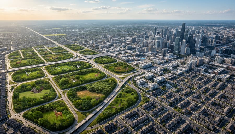
Urban sprawl doesn’t just consume natural areas, it tears them apart. When development leapfrogs outward in scattered, low-density patterns, forests, wetlands, and grasslands that once stretched unbroken become fragmented into smaller, isolated patches. This fragmentation threatens biodiversity more severely than simple habitat loss, because edge effects, restricted movement, and genetic isolation compound to push species toward local extinction.
Consider how a new subdivision carved through a woodland creates barriers that wildlife can’t easily cross. Roads, driveways, and fences interrupt migration routes and daily movement patterns. Species that require large territories, like black bears or cougars, find their range suddenly bisected by human infrastructure. Smaller animals face similar challenges: salamanders can’t navigate hot pavement to reach breeding ponds, and ground-nesting birds lose protective cover at forest edges where predators thrive.
The ecological consequences ripple outward. Smaller habitat patches support fewer individuals of each species, reducing genetic diversity and making populations vulnerable to disease, climate fluctuations, and local disasters. When patches lose connectivity, animals can’t disperse to new territories, find mates outside their immediate group, or recolonize areas after disturbances. Plant communities also suffer as pollinators and seed dispersers can’t move freely between fragments.
Despite stronger wildlife protections in recent years, sprawl development often proceeds with minimal consideration for habitat connectivity. The cumulative impact of hundreds of small developments creates a landscape hostile to the species that depend on intact ecosystems, accelerating biodiversity loss across Canada’s urban-rural fringe.
Water Quality and Watershed Impacts
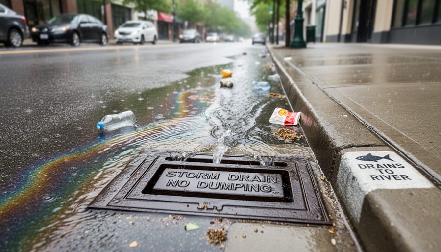
When sprawl development replaces forests, wetlands, and grasslands with roads, parking lots, and buildings, it dramatically increases the amount of impervious surface covering the land. These hard surfaces, asphalt, concrete, and rooftops, prevent rainwater from soaking into the ground the way natural landscapes do. Instead of filtering slowly through soil and recharging underground aquifers, precipitation runs off quickly across these sealed surfaces, picking up speed and volume as it flows toward storm drains and waterways.
This surge of stormwater runoff carries a toxic cocktail of pollutants. Oil and grease from vehicles, heavy metals from brake pads, fertilizers and pesticides from lawns, road salt, and sediment from construction sites all wash directly into streams, rivers, and lakes. The sheer volume of water rushing off impervious surfaces also erodes stream banks, destabilizes aquatic habitats, and overwhelms natural drainage systems that evolved to handle gradual water infiltration rather than sudden floods.
Meanwhile, the groundwater that supplies wells, feeds wetlands, and maintains stream flows during dry periods gets starved. Studies show that when impervious cover exceeds ten percent of a watershed, stream health begins to decline noticeably. At twenty-five percent coverage, common in sprawling suburban developments, aquatic ecosystems suffer severe degradation. For Indigenous communities and rural residents who depend on wells and natural water sources, sprawl’s water quality impacts represent both a health threat and a disruption of traditional relationships with the land.
The cumulative effect is watershed-scale damage that’s difficult and expensive to reverse, making prevention through smarter land use patterns far more effective than attempting cleanup after sprawl has already reshaped the landscape.
Why Urban Sprawl Increases Air and Water Pollution
Urban sprawl drives air and water pollution through two interconnected mechanisms that compound environmental harm far beyond what compact development creates. The first pathway is straightforward: sprawl’s automobile dependence generates massive air pollution. When daily destinations, workplaces, schools, grocery stores, services, spread across large geographic areas with low-density development, residents have no practical alternative to driving. Every commute, errand, and school run requires a personal vehicle, multiplying the number of vehicle miles traveled across the population. This relentless automobile use releases nitrogen oxides, particulate matter, volatile organic compounds, and carbon monoxide into the air. The pollution burden intensifies during peak traffic hours when engines idle in congestion, burning fuel without forward movement. Transitioning to sustainable transportation options like public transit, cycling, or walking becomes nearly impossible in sprawl patterns where destinations sit miles apart with no connected infrastructure.
The second pathway attacks water quality through impervious surfaces. Roads, parking lots, driveways, and building rooftops replace soil and vegetation that once absorbed rainfall. When rain hits these sealed surfaces, it cannot infiltrate the ground. Instead, water rushes across pavement, collecting motor oil, tire particles, brake dust, road salt, fertilizers from lawns, and other pollutants before flowing directly into storm drains, streams, and rivers. This non-point-source pollution lacks a single discharge pipe to regulate, making it particularly difficult to control. The sheer scale of impervious coverage in sprawl developments overwhelms natural filtration systems that watersheds provide. Groundwater recharge drops while contaminated runoff spikes, degrading drinking water sources and aquatic ecosystems downstream. The cumulative environmental burden from these twin pollution pathways, airborne emissions and water contamination, represents one of sprawl’s most persistent and damaging legacies.
Legal and Policy Tools to Address Urban Sprawl in Canada
Canada’s legal framework offers multiple pathways to challenge unsustainable sprawl and protect environmental integrity. While development decisions often favor short-term economic arguments, environmental laws and Indigenous rights create powerful counterweights when communities and advocates know how to deploy them.
At the municipal level, official community plans and zoning bylaws govern where and how development occurs. Citizens can challenge plan amendments that enable sprawl by participating in public hearings, submitting written objections, and in some cases appealing decisions to provincial tribunals. When municipalities approve developments that contradict their own sustainability policies or ignore cumulative environmental impacts, legal challenges can force reconsideration.
Provincial environmental assessment regimes require developers to evaluate potential harm before major projects proceed. In Ontario, the Environmental Assessment Act applies to public infrastructure like highways that enable sprawl. British Columbia’s Environmental Assessment Act covers large developments, while Quebec’s system evaluates projects based on thresholds that can capture significant suburban expansions. These processes create opportunities for intervention: requesting participant funding, submitting technical evidence, and highlighting inadequate impact analysis, particularly regarding cumulative effects on watersheds, habitat connectivity, and species survival.
Federal law enters when sprawl threatens protected species. The Species at Risk Act prohibits destruction of critical habitat for listed species. When development proposals would fragment habitat corridors or destroy breeding grounds, affected communities can petition the federal government to enforce protections or initiate judicial review when enforcement fails.
Key legal tools available to communities include:
- Official plan challenges through municipal appeals processes
- Environmental assessment interventions with technical evidence submissions
- Conservation easements negotiated with private landowners to prevent development
- Urban growth boundaries established through regional planning frameworks
- Smart growth policy advocacy within municipal comprehensive reviews
- Indigenous land rights assertions under treaty obligations and UNDRIP
Indigenous communities hold unique legal standing when sprawl encroaches on traditional territories. The duty to consult and accommodate, affirmed in landmark Supreme Court decisions, requires governments to engage meaningfully with Indigenous nations before approving developments affecting their rights. Many sprawl proposals threaten culturally significant landscapes, traditional hunting grounds, and sacred sites. Indigenous legal challenges have successfully halted or modified projects that failed to respect these obligations, creating precedents that strengthen environmental protection for all Canadians.
Collaborative approaches yield strongest results. Environmental organizations, municipal residents, and Indigenous communities working together can marshal scientific evidence, legal expertise, and community knowledge to challenge destructive sprawl patterns and advocate for sustainable alternatives that respect both ecological limits and cultural heritage.
How Urban Sprawl Is Used (and Misused) in Development Contexts
Developers and municipalities frequently justify sprawl-style development with three main arguments: housing affordability, economic growth, and expanding the tax base. The logic sounds compelling at first glance. Building on cheaper land outside city cores can lower per-unit housing costs. Attracting big-box retailers and industrial parks promises jobs and commercial activity. Spreading development across a wider geographic area theoretically brings more properties onto the tax rolls.
These rationales crumble under scrutiny when long-term costs surface. Lower-density development demands expensive infrastructure over greater distances: roads, water lines, sewers, electrical grids, emergency services. Municipalities end up paying more per capita to serve sprawl than compact neighborhoods, straining budgets for decades. The initial tax revenue gains get consumed by maintenance obligations that outlast any short-term economic boost.
Housing affordability claims ignore hidden costs transferred to residents. Automobile dependence from geographic separation of daily destinations forces households to own multiple vehicles, spend hours commuting, and absorb fuel expenses that can exceed any savings on purchase price. Environmental degradation from increased energy consumption and habitat loss creates public health burdens and climate adaptation costs that entire communities bear.
Low-density development has legitimate applications in specific contexts: rural areas with existing agriculture, resource-based communities tied to dispersed industries, or regions with genuine geographic constraints. The harm multiplies when sprawl patterns replace farmland and forests near urban centers where compact alternatives exist, or when municipalities prioritize short-term developer profits over frameworks that measure prosperity through well-being economies rather than endless outward expansion.
The difference lies in intentionality and environmental accounting. Sprawl becomes misuse when decision-makers ignore cumulative impacts, defer infrastructure costs to future generations, and dismiss sustainable alternatives that could meet the same needs without sacrificing natural areas and long-term community resilience.
Frequently Asked Questions About Urban Sprawl and the Environment
What are the main impacts of urban sprawl on the environment?
Urban sprawl increases energy consumption and greenhouse gas emissions through automobile dependence, degrades soil through large-lot development on agricultural land and forests, fragments wildlife habitats into isolated patches, and pollutes water systems through expanded impervious surfaces that channel runoff into watersheds.
Can urban sprawl be stopped or reversed?
While challenging, sprawl can be slowed through municipal land use policies that prioritize densification over outward expansion, provincial environmental assessments that scrutinize development impacts, and legal challenges to projects that violate environmental protections. Reversing existing sprawl requires deliberate infill development and habitat restoration efforts.
What alternatives exist to sprawl-style development?
Smart growth strategies focus on compact, walkable neighborhoods with mixed-use development that combines housing, retail, and workplaces within short distances. Transit-oriented development clusters housing near public transportation, while nature-based solutions integrate green infrastructure like wetlands and urban forests to manage stormwater and preserve ecological functions within city boundaries.
How does urban sprawl affect Indigenous lands and rights?
Urban expansion often encroaches on traditional territories and treaty lands, disrupting hunting, fishing, and gathering practices while fragmenting sacred sites and cultural landscapes. Indigenous communities have legal standing to challenge developments that threaten their rights, and their participation in land use planning offers valuable perspectives on sustainable development that respects ecological limits.
What can individuals do to combat urban sprawl?
Citizens can attend municipal planning meetings to advocate for density over expansion, support candidates who prioritize sustainable development, choose housing in walkable neighborhoods rather than distant subdivisions, and join environmental groups that use legal tools to challenge harmful sprawl projects. Amplifying Indigenous voices in development decisions strengthens opposition to projects that disregard environmental and cultural impacts.
Understanding these common concerns helps frame the sprawl debate beyond abstract environmental concepts. The question of reversibility matters because many communities feel locked into existing patterns, yet legal and policy interventions demonstrate that change remains possible. Alternatives like densification and mixed-use neighborhoods prove that cities can accommodate growth without consuming surrounding natural areas. Recognizing how sprawl intersects with Indigenous rights connects environmental protection to broader justice issues, while identifying concrete actions empowers individuals to contribute to systemic change rather than feeling helpless against large-scale development pressures.
The environmental toll of urban sprawl is clear and urgent. Low-density development that stretches across agricultural land, forests, and watersheds creates a cascade of harm: increased greenhouse gas emissions from automobile dependence, degraded soil and water quality, fragmented wildlife habitat, and lost natural areas that communities and ecosystems depend on. These are not abstract future threats. They are measurable consequences unfolding across Canada right now, affecting both human populations and the natural world we share.
Yet the path forward is equally clear. Legal tools exist to challenge harmful development decisions, enforce environmental protections, and hold governments and developers accountable. Municipal planning laws, environmental assessment processes, and federal protections like the Species at Risk Act provide avenues for meaningful intervention. Community advocacy, when combined with legal expertise, has proven powerful in redirecting growth toward denser, transit-oriented patterns that reduce environmental impact.
Change requires collective action. Indigenous communities, whose traditional territories face encroachment from urban expansion, bring essential knowledge and legal standing to these fights. Environmental organizations, legal professionals, and concerned citizens can unite to demand smarter growth policies and push back against sprawl that sacrifices long-term ecological health for short-term development gain.
The question is not whether sustainable alternatives to sprawl are possible. They are. The question is whether we will mobilize the legal, political, and community resources needed to make them reality. Nature’s Resilience Canada is committed to building that united front, using law as a lever for environmental justice and ensuring that development decisions respect both ecological limits and Indigenous rights.